Saturday, July 12, 2008

St. Lucia to Trinidad

The marina at Marigot Harbour, St. Lucia, was our favorite so far. These two pictures were taken from the pool deck of the Discovery Resort overlooking the yacht basin. We spent one entire day laying around the pool, and being pampered for a change.
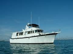
People were always stopping on the little bridge to admire our boat. I think they are fascinated by the scooters on the flybridge.


We departed Marigot Bay at 9:00am on July 7, for the 49-mile run south to St. Vincent. We had wonderfully calm seas and light winds.

At the southern end of St. Lucia, are these two distinctive geological features, known locally as "The Pitons". They're enormous cones jutting up, and between the two are two lovely bays. As you can imagine, the resorts there are fabulous.

View of the approach to The Pitons


Not sure if you can see the mast of the sailboat in this picture, but if so, it affords a little perspective of the size of these things....


View of The Pitons looking back as we depart St. Lucia, southward towards St. Vincent


We dropped anchor at 4:30pm, in the lovely little deep-water anchorage of Wallilabou (pronounced wally-la-bow), on the island of St. Vincent. This harbour was the site of much of the outdoor action in the first "Pirates of the Caribbean" movie, with Johnny Depp as the pirate captain. A lot of the sets remain intact.


If you look closely, you can see the wooden coffins leaning against the front of the building. In one scene, Johnny Depp steps out of one of them. They're made of plywood, covered with fiberglass, and painted to look like old wood. Seems to me like a lot of trouble. There are plenty of old weathered buildings on the islands that they could have used as sources of real aged wood.


Pirates of the Caribbean film buffs will recognize these as the gallows where Johnny Depp was to be hanged. They built two. One was for the beginning of the hanging scene, and is upright, and the other was for the end of the scene, where the gallows collapses, saving our hero.


The harbour has a very steep slope to the bottom. We anchored the front of the boat in 35 feet of water. Our friendly neighborhood boatman, Alex, took a line ashore from our stern, and tied it to a firm structure, thus aligning us perpendicular to the shore, and to the inbound surf. It worked quite well.
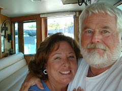
Alex also ferried me to the local harbourside restaurant, where I was inquiring about the whereabouts of the Customs and Immigration officals that are supposed to be there. They were AWOL - attending the Carnival festival in the capitol. So, we had a beer and went back to the boat.
Alex and me, returning to KINGDOM


Sunset at Wallilabou harbour, St. Vincent - We had a lovely evening getting acquainted with the owners of this catamaran, Ron and Debbie. It was the only other boat in the harbour. We learned that they are friends of Mike and Beth Smith, whom we met in St. Kitts. Ron is another semi-retired MD who teaches part-time at the various medical schools around the Caribbean!


Another wonderful geologic feature, also used in the movie as backdrop. We think there were skeletons hanging between the pillars of the rock in one scene.


Typical fishing village on the western coast of St. Vincent.


We left Wallilabou at 7:15am on Tuesday, July 8, for the 50-mile run to Carriacou. We arrived at the port of Hillsbourough around 2:30pm. We took the dinghy ashore to clear customs and immigration. It was really hot there! When we got back aboard, we decided that the harbour was too rolly for us, so we pulled the anchor, and motored south a couple of miles to the harbour in Tyrell Bay. It was much more protected from the ocean surge, and we were more comfortable there.
As soon as we anchored, our friends Dustin and Courtney, Captain and Mate of the charter catamaran "Frangine", motored over to say hello. We had a great time when we met them in St. Kitts. It was good to see them again, but since they had guests aboard their boat, they couldn't stay and visit long. They did suggest a couple of good anchorages we could use in Grenada.

We departed Tyrell Bay, Carriacou very early (6:15am) on Wednesday, July 9, because we were asked to move our boat out of the path of an incoming freighter. This was only a 35-mile run in good conditions down to the extreme south end of Grenada. We arrived there about 12:45pm, and anchored in a small protected harbour formed between Hog Island and the mainland of Grenada. There were at least 30 boats in this small harbour. Since we had cleared customs and immigration in Carriacou, we did not need to do it again in Grenada, as both islands are under the same government.

The next day, July 10, we made the last long (82 mile) leg of our journey to Trinidad. We left at 6:00am, since we knew this would be at least a 10 hour day. As it turned out, it was a 14-hour run, against the strong equatorial current, which cut our speed by as much as 3 knots at times. In addition, the seas were kicking up and we dealt with 6' to 8' swells on the beam nearly all day. We also ran in and out of rain squalls throughout the day. It was NOT what we consider ideal conditions, but it was still do-able for us. We took only a few pictures on this passage. One was of this gigantic rainbow, which we encountered early in the day.


Volcanic rock formations of the southern coast of Grenada.


We arrived in Chaguaramas Bay, Trinidad after dark, about 7:45pm. We picked our way into the anchorage and dropped the hook. We were exhausted from this passage. Next morning, we went ashore to clear customs and immigration. Then we made arrangements to bring the boat into Coral Cove Marina, where it will remain during our three-week trip to Phoenix. We leave on July 17, and return August 12.

While we are in port here, we will have some time for maintenance. The boat's 24-volt battery bank needs to be replaced, and our Single Sideband radio needs adjustment or repair. I will also change the oil and filters on the main engines and the large generator, check the condition of fuel filters, etc.

We will be taking more photos and updating the blog again in a few days, once we get rested up again..

Sunday, July 6, 2008

Party at the Shipwreck Bar - St. Kitts

Lest anyone think that we don't make good use of our time ashore, I thought we would include these pictures of our last afternoon in St. Kitts. Our friends Beth and Mike Smith took us out to the Shipwreck Bar on Sunday afternoon, and we ran into another couple, Denise and TJ, whom we had met earlier in the week at a Karaoke night (another story for another time...)

The Shipwreck is right on the beach, and provided cold beer and live music all afternoon. As you can see, we had to get up and dance, if you can call what we do "dancing"! Anyway, the locals seemed to get a kick out of our antics...

Only 470 miles to Trinidad -


Professor Mike Smith


Susan demonstrates her Italian heritage - (sign language)


Dancin' fools are we...


Susan and Beth Smith


You talkin' to ME?


Walt and TJ (he's the one in the cool hat)


Left to right - Mike Smith, Denise, Susan, Beth Smith, Walt, TJ


Bustin' a move on the dance floor


See? I told you. We waste no opportunity to enjoy life!

Saturday, July 5, 2008

St. Kitts, West Indies to St. Lucia, Windward Islands

We are finally on our way south again, after waiting out the weather for two weeks in St. Kitts!

July 1st - I had to clear out with customs and check out of the marina, first thing this morning, which occasioned a bit of a late start - 9:30am.

Once we cleared the lee of the islands of St. Kitts and Nevis, we had a fairly bumpy ride to Montserrat, a 51-mile run overall. However, we arrived about 4:30pm and dropped the hook in Rendevous Bay, a very small bay on the extreme northwestern end of Montserrat. It was a bit rolly overnight, but very picturesque, as we were surrounded by sheer cliffs, a small sandy beach, a deserted house on the beach, plus one black goat .

At anchor in Rendevous Bay, Montserrat


Monserrat is an active volcano. Recently the caldera's lava dome has been rising, leading researchers to expect some sort of "event" to occur sometime soon.

The trade winds in this area generally are out of the east, which blows lava dust to the leeward (western) side of the island. For that reason, the government recommends that boats transiting the island travel on the windward (eastern) side, out in the open Atlantic.

View of the volcano and lava fields on the eastern side of Montserrat. The last eruption buried a major portion of the principal city, ruins of which can be seen sticking up here and there amid the lava field. Since that event, most of the populace has moved to the northern end of the island. There is an intervening mountain range which, they believe, will protect them from future lava flows from the volcano.

View of Montserrat's lava flow


July 2 - Our next stop was at the village of Deshailes (pronounced Day-hay) Bay, near the northwestern end of the island of Guadaloupe. We left Montserrat at 6:45am, and arrived at anchor by 1:15pm. The 40-mile passage was very bumpy, with 4' to 6' seas, and we were happy to arrive in this quaint village in the protected harbour to rest up. Guadaloupe is a large island with lots of anchorages, both large and small. It is actually considered French soil, and is quite prosperous and well-developed for tourism and cruising. We did not go ashore here, but we will definitely return when we can spend a few weeks exploring. It has a great reputation for food and wine, as you might imagine!

Ville Deshailes, Guadaloupe


Thursday, July 3 - We hoisted our hook at 6:15am for this 51-mile run down-island to Dominica.

The cruise down the lee side of Guadaloupe was both calm and very scenic. Lots of shoreside villages, with good anchorages. We saw many boats at rest in the lee of the island.

However, the passage between Guadaloupe and Dominica was another story. We dealt with strong adverse currents, 30-knot winds, and 6' seas.

We arrived in Portsmouth Harbour, Dominica at 1:45pm. This small village was one of our ports of call on the itinerary of the Windstar Cruise, that Susan and I took several years ago. That cruise was pivotal in our deciding to buy our own boat upon our retirement. We have been looking forward to returning to the islands we visited on that cruise.

As we approached the quiet harbour, the local boatman known as "Lawrence of Arabia" met us. We had read about him in our cruising guide, and were happy to meet him. He, along with others like him, provide all sorts of services to the cruising boats arriving in this lovely harbour. I asked him to take me to the customs and immigration office to clear in, and I was very happy that I did. I would have had a tough time even locating it otherwise!

Later in the day, Lawrence took us ashore to "The Purple Turtle" beachfront restaurant and cyber-cafe. There, we were able to access the internet for weather updates, check emails, and have dinner. We love the people of Dominica. They were so hospitable!

The two-story structure in the center of this photo is "The Purple Turtle"


The next morning, as we departed Portsmouth, Dominica -

View of the pier where Windstar tied up during our previous visit. The old Fort overlooks the pier and harbour, and is now part of a protected park and historical area.


Friday, July 4th - Today was a 53-mile run down to St. Pierre, Martinique. This was an easy run, with seas running less than 4' in relatively light winds.

St. Pierre is situated at the foot of a dormant volcano, which last erupted in 1902, wiping out the town and killing some 22,000 residents of St. Pierre.

View of the volcano, as we approach the northern end of Martinique.


View of the volcano, towering over the town of St. Pierre, Martinique


We anchored here at 2:3opm in 22 feet of water, just 50 yards off the beach and town dock. This was a quiet anchorage, with only a few cruising boats in the harbour, since it is off-season. We did not go ashore here, but will definitely return this winter.

The town of St. Pierre as it looks today


Saturday, July 5th - Leaving early, at 6:30am, we headed toward St. Lucia, one of our favorite islands of the Caribbean. This was an easy 47-mile leg, in calm seas and light air. Our cruising guide recommended the small harbour of Marigot Bay, so we opted to go in to see if there was room for us to anchor. Instead, the Marigot Marina offered a sweet deal for an overnight slip, and we accepted. Since we had been moving and anchoring out every night since we left St. Kitts, we felt we deserved a couple of nights at a dock, with access to good restaurants, as well as onboard free internet!

View of Marigot Harbour as we entered


Marigot Harbour is almost like a Norwegian Fijord in shape - narrow and deeply cut into the surrounding cliffs. It has an inner lagoon, where the marina is located, and it is considered one of the few truly safe Hurricane Holes in this part of the Caribbean. They have never lost a boat during a hurricane!

Here are located two lovely resorts, and a fleet of Moorings charter boats is operated from the marina. They must have 25 catamarans and mono-hulls available. Since it is off-season, many of them are in port now.

We were also delighted to find the first truly good bread in the islands, at a bakery not 50 yards from the boat. We were able to feast on fresh-baked French pastries, and bought several loaves of Sourdough Bread for our larder. Last night, we enjoyed a fine-dining experience at the Discovery Resort's restaurant overlooking the marina. We will be truly sorry to leave here tomorrow morning.
It simply doesn't get any better than this! Check out the sunset, as seen last night from our slip!


Tomorrow - On to St. Vincent and the Grenadines...